Report Introduction
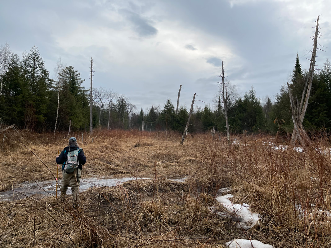
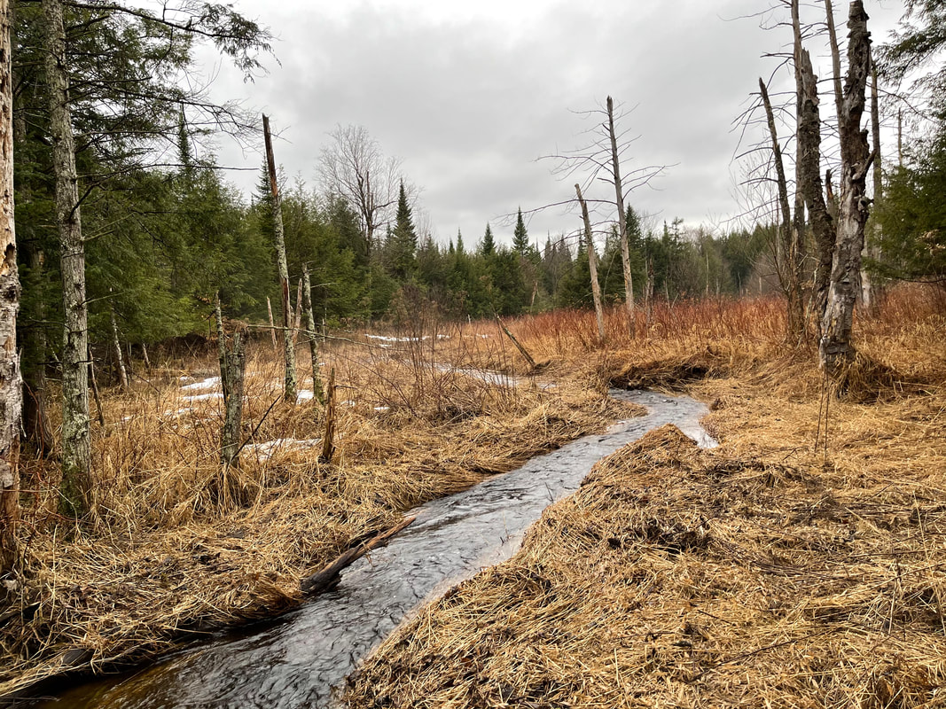
During the fall of 2020, a stream walk was undertaken on Marsh Brook to determine possible sources of sediment contributing to the large delta in Lake Carmi at the confluence of Marsh Brook. The stream walk was done over four days 8/31, 9/25, 10/2, and 10/6. The stream walk was led by River Scientist Staci Pomeroy. Joining Staci was Peter Benevento (for the first day), Tucker Wehner (all days) and Karen Bates (last 3 days). Tucker is the Watershed Coordinator for the Franklin Watershed Committee (FWC), Peter is a member of the FWC, and Karen Bates is the Tactical Basin Planner for this area.
The stream walk was conducted to make observations of the current condition of the stream, document bank erosion, and identify possible project areas for improvement to the stream condition and/or reduce sediment loading to the stream. A Phase 2 Stream Geomorphic Assessment was done in 2006 on reaches M4T2.3S8.02 and M4T2.3S8.04 by Brendan O’Shea of Carmi Consulting. The stream walk provided a way to review how the stream has changed over the last 14 years and to capture information on additional reaches.
The stream walk was conducted to make observations of the current condition of the stream, document bank erosion, and identify possible project areas for improvement to the stream condition and/or reduce sediment loading to the stream. A Phase 2 Stream Geomorphic Assessment was done in 2006 on reaches M4T2.3S8.02 and M4T2.3S8.04 by Brendan O’Shea of Carmi Consulting. The stream walk provided a way to review how the stream has changed over the last 14 years and to capture information on additional reaches.
Report Executive Summary
|
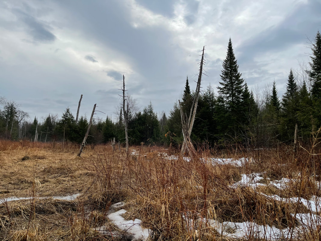
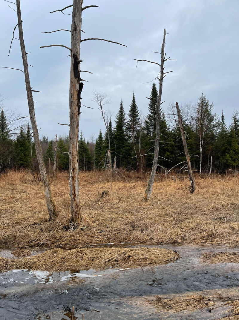
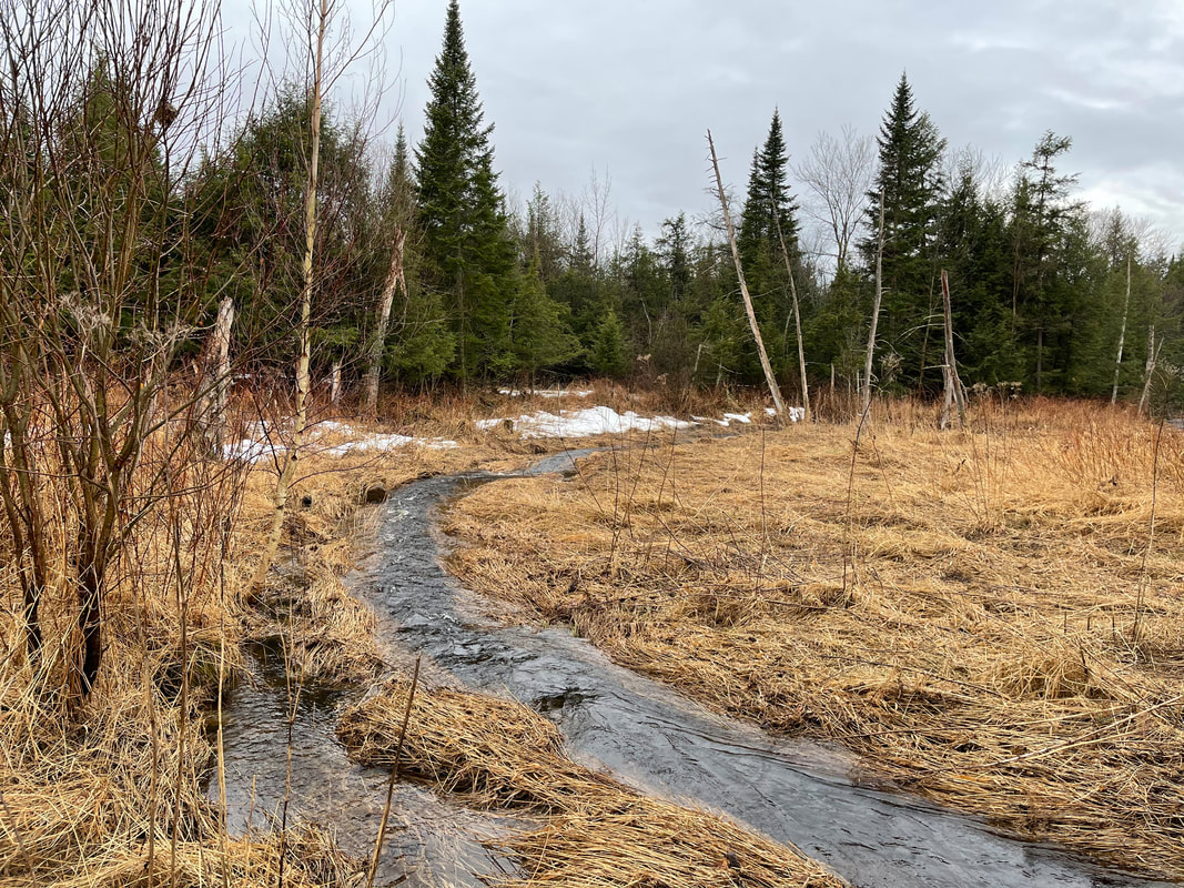
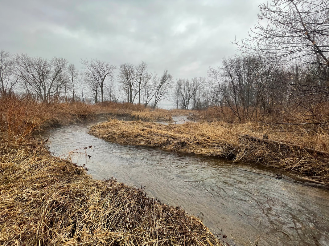
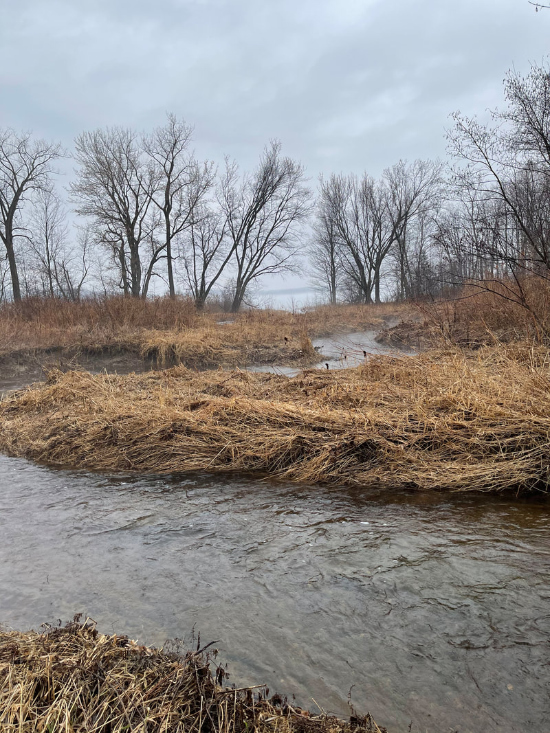
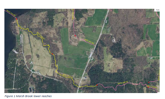
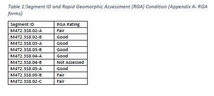
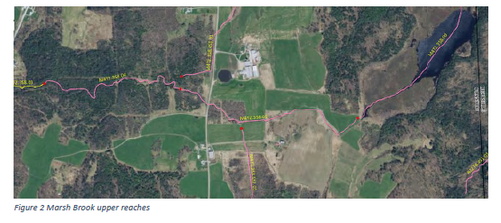
The stream walk was conducted over four reaches: from the confluence with Lake Carmi to the upper reaches of the brook (Figure 1 & 2). These reaches were further refined through segmentation to capture differences along the brook for stream type and conditions; a total of 9 segments were created (Table 1). One segment, M4T2.3S8.04-B, was not evaluated due to the difficulty of walking the segment in a deep narrow channel with very high vegetation. Suggestion is to evaluate this segment in late winter /early spring when dense herbaceous vegetation is limited. Of the 8 segments, 3 were in fair condition and the remaining 5 were in good condition. The three segments in fair condition were the one most downstream and the two most upper segments assessed. Based on a map and remote sensing review of the segment M4T2.3S8.04-B is likely in poor to fair condition.
|
|
For more information and to read the full report written by DEC River Scientist Staci Pomeroy, click the link below:
| Marsh Brook Stream Walk Report 2020 |


Follow up stream walk Spring 2021:
On Friday March 26th, 2021 we had the opportunity to join Staci Pomeroi, DEC River Scientist, on a follow up walk of several portions of the Marsh Brook which we were unable to see clearly due to high vegetation. We extend our gratitude to Staci for her continued effort and assistance in our work! We would also like to extend our thanks to Richard Budreau for letting us walk the portion of Marsh Brook on his property!
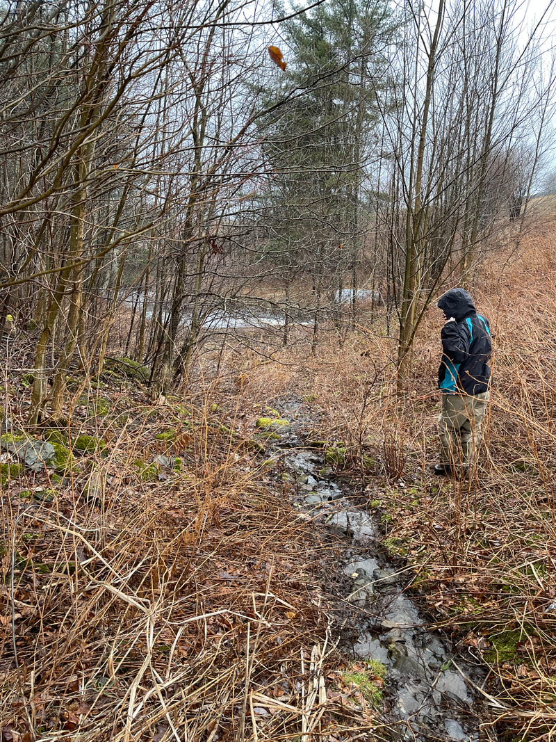
We looked at three sections of the Marsh Brook on this follow up walk.
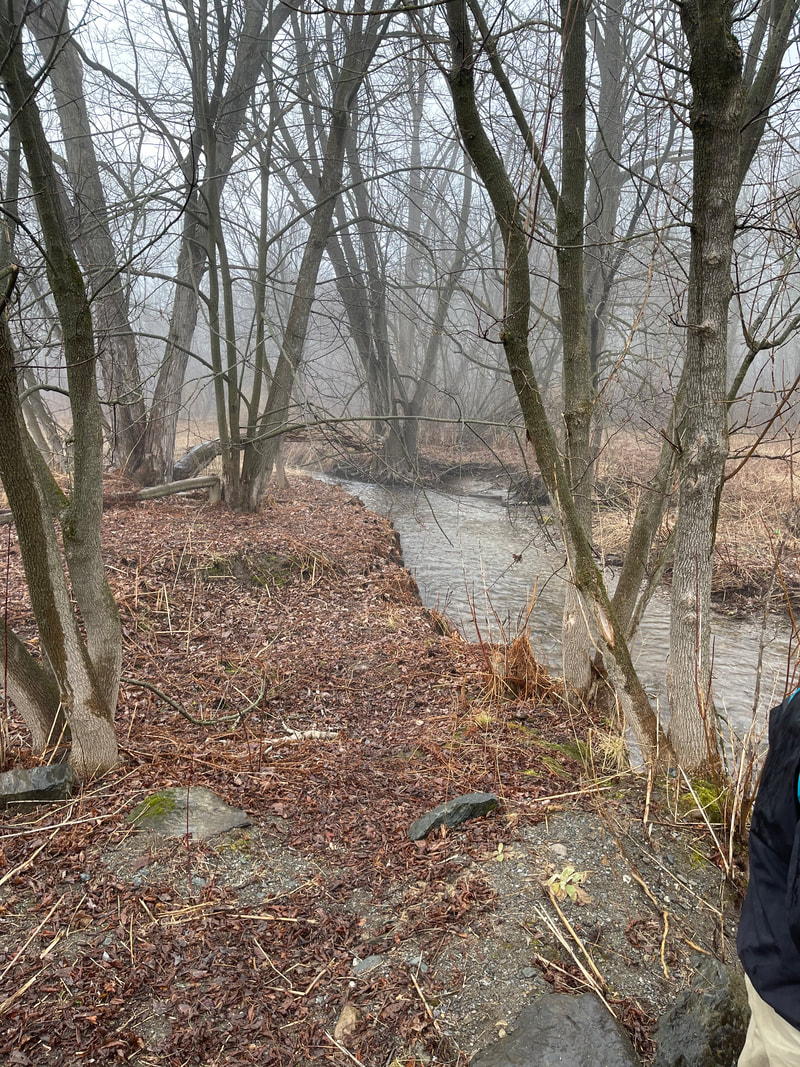
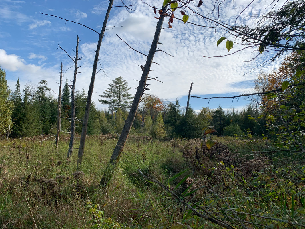
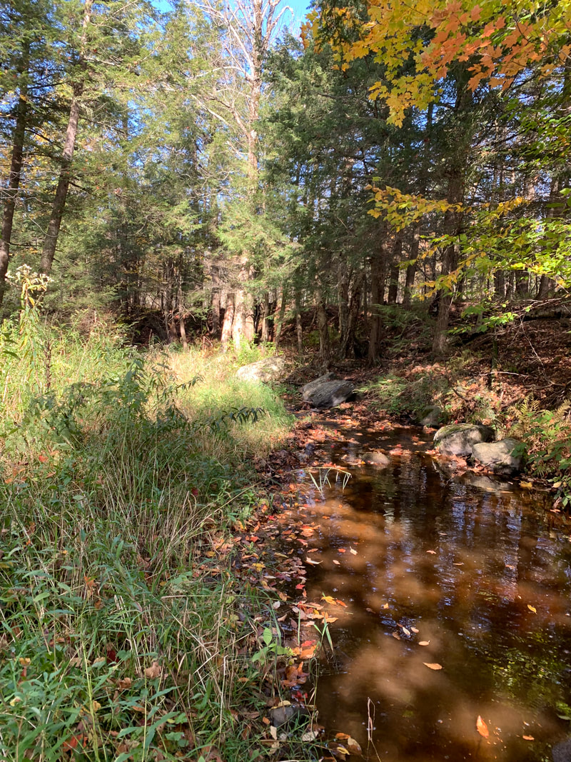
The first, on Richard Budreau's property, was a beautiful, healthy section of the brook which was great to see! There was little to no incision along stream banks and the whole portion of the stream had fantastic flood plain access and connection.
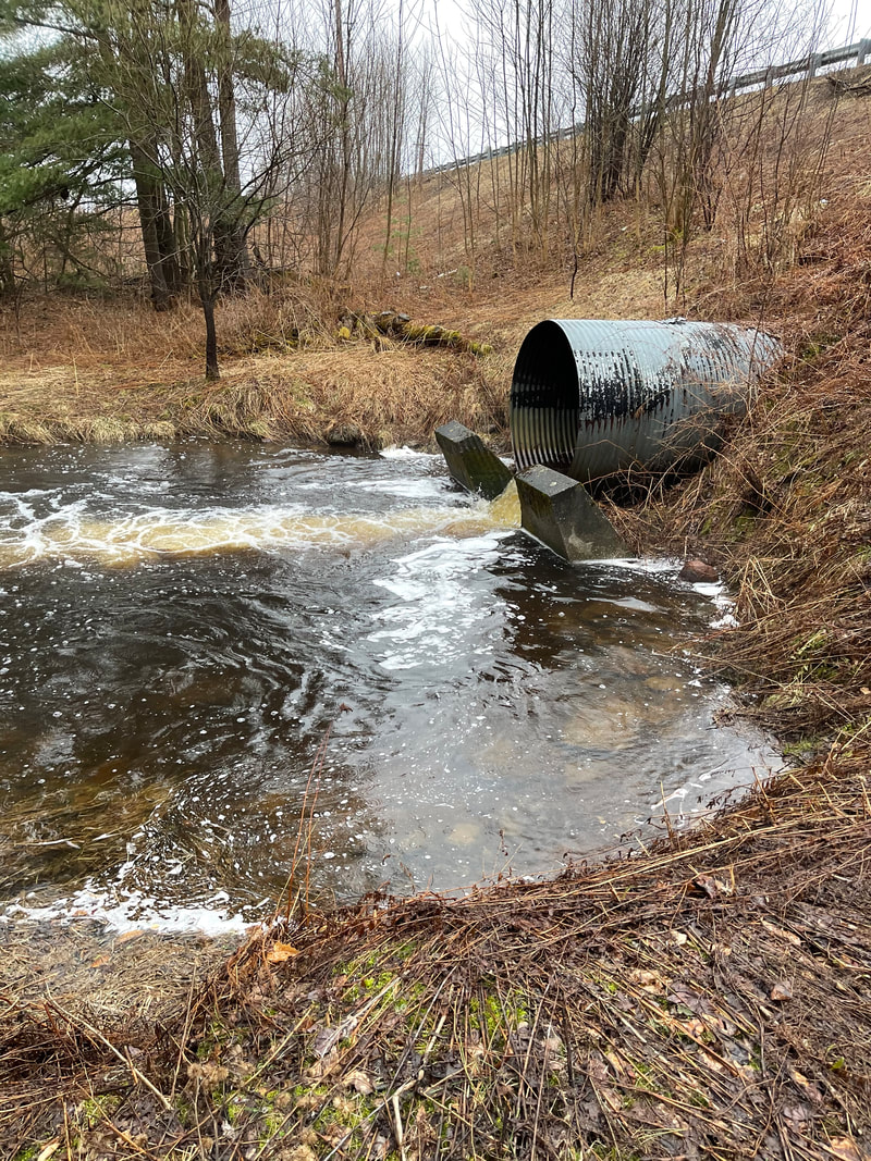
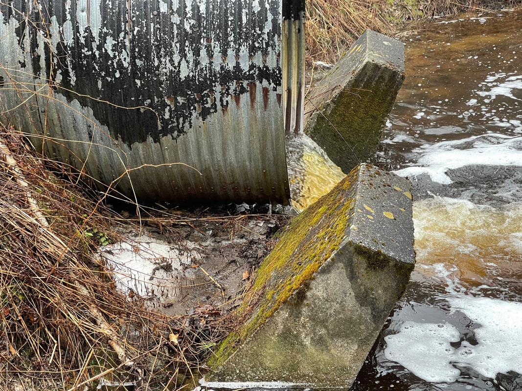
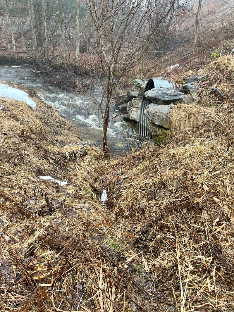
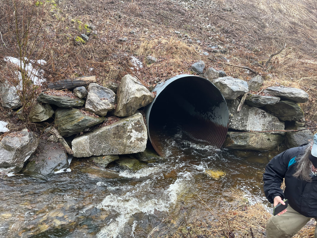
The second spot we revisited was the upstream and downstream side of the large culvert on Route 236 right next to the entrance to Lake Carmi State Park. This culvert was identified as likely being the largest source of sediment to the brook by Staci in the Marsh Brook Report she wrote following our stream walk in the fall. After revisiting the site, it is clear that this is one of the largest, if not the largest sources of sediment to the brook. This is a priority area for us for either a full culvert replacement, or a project to remediate the issue until the culvert can be replaced.
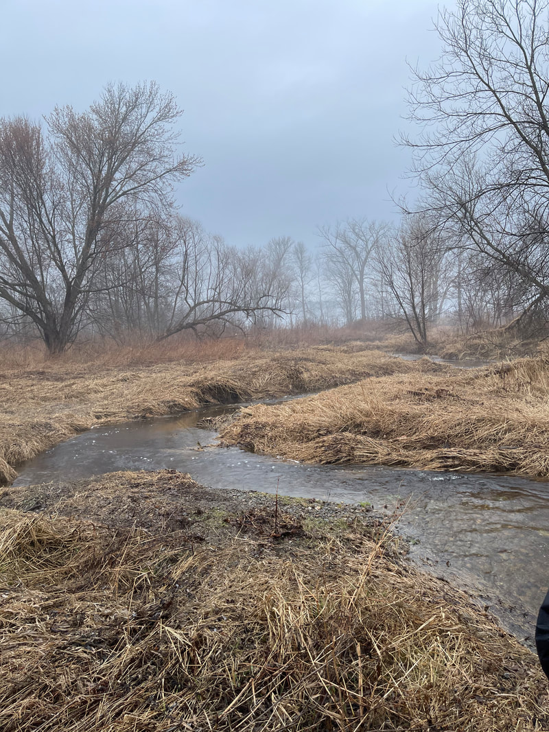
The final section we looked at was the the mouth of Marsh Brook. We found there to be less flood plain access than areas upstream, however it appears that the brook is slowly healing itself from historical uses and will likely continue to heal over time.
Overall, the walk went very well and it was exciting to get back up to the lake to continue our clean water work! We look forward to the follow up report that Staci will produce and will post that when it is completed.
The first, on Richard Budreau's property, was a beautiful, healthy section of the brook which was great to see! There was little to no incision along stream banks and the whole portion of the stream had fantastic flood plain access and connection.
The second spot we revisited was the upstream and downstream side of the large culvert on Route 236 right next to the entrance to Lake Carmi State Park. This culvert was identified as likely being the largest source of sediment to the brook by Staci in the Marsh Brook Report she wrote following our stream walk in the fall. After revisiting the site, it is clear that this is one of the largest, if not the largest sources of sediment to the brook. This is a priority area for us for either a full culvert replacement, or a project to remediate the issue until the culvert can be replaced.
The final section we looked at was the the mouth of Marsh Brook. We found there to be less flood plain access than areas upstream, however it appears that the brook is slowly healing itself from historical uses and will likely continue to heal over time.
Overall, the walk went very well and it was exciting to get back up to the lake to continue our clean water work! We look forward to the follow up report that Staci will produce and will post that when it is completed.